|
| wnc business & community directory |
|
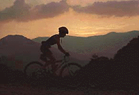
You can park at the Arboretum; they encourage recreational folk to utilize their facility for parking while they enjoy the area (and their grounds are a wonderful place to explore if you have the time). If you prefer, there's parking further down the road, but on weekends and some evenings, it's tight. Get your bike in gear and remember your helmet. Exit the Arboretum and head left toward Lake Powhata; you'll see a paved road to the right about � mile down the road. This is called Rice Pinnacle Road. Turn right and stay to right, following the gravel road. You'll pass a gate that is usually closed. Stay on this gravel road until it intersects with a road to the right called Ledford Branch. Turn left on Ledford Branch and follow this road that will wind up, giving you some nice views of the Bent Creek watershed. In June and July, this is a good area to hunt for blackberries and wineberries. There are a couple single tracks leading to the left off of this gravel road. The higher you go, of course, the more downhill excitement you'll experience, so I would advise climbing higher for the greater fun-factor. If you continue on around, this road will begin to slope down again and you'll see a single track on your right in the bend of the road. This is called Side Hill Trail. Take this trail for a good single-track climb. You will reach a plateau in the trail and you will have a choice to go down the other side on the same trail or climb further taking a sharp right and heading up another single track. Of course, I advise the climb. It'll tax your lungs a little, but is well worth it. When you reach the intersection with another trail, you can take your pick. Turning right will lead back down to the gravel road that you rode up on and you can take one of the single tracks off the road to the bottom of the watershed. This makes for a nice ride. OR . . . you can climb (which I recommend). You'll end up at a place I hear most refer to as "4-Points." At this summit, all choices lead down. Just be careful if you head to the back side of the ridge that overlooks the neighboring watershed that you don't start downhill - you may not be too happy if you ended up in Candler! If you head down the trail to the left, you'll eventually end up on an old logging road that intersects with a more heavily used gravel road. Take a left and you'll lead back to the Lake Powhatan area where the campground is located. Heading left on the pave road will lead you back to the arboretum. Happy cycling! popular activities for the whole family: hiking . biking . ice skating . snow skiing .rafting . kayak & canoe . rock climbing . golf . Hot air balloon rides . gem mining water sports . family fun . scenic drives . shopping . horsebackriding | ||||||