OBSERVING mitigation hiking guidelines we will meet at the trailhead, however, if you decide to carpool I suggest you wear masks and bring hand wipes to wipe down door handles…surfaces. Post where you plan to meet.
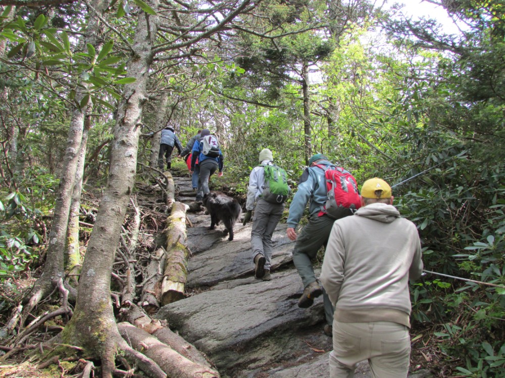
HIKE DESCRIPTION: We will begin hiking the Flint Creek River Trail return taking a ridgline loop spur, pick up the White Cliffs spur trail plus an optional trail. The trails are mostly under forest hardwoods, Flint Creek Trail follows the winding creek trail which snakes through the gorge fed by small streams and waterfalls. There are 10 log bridge-over-creek crossing plus a few smaller step-over streams. Like the Smoky Mountains National Park, Rocky Fork State Park has one of the most Biological diverse floras in the country. The trails are flat to rolling with moderate and steep climbing sections.
Elevation Gain Estimate.? 2,100-2,400′ (Level 7)**
PACE: See below*
DOGS: Friendly dogs are welcome and must remain close to their owners. Water is continuously available along the creek trail.
IF YOU SIGN UP THEN CHANGE YOUR MIND CHANGE YOUR RSVP TO “NOT ATTENDING” TO CLEAR A SPOT FOR ANOTHER HIKER
TRAIL HEAD DIRECTIONS:
I-26 West 31 miles and take Exit 50 toward Flag Pond Rd. Proceed for approx. 0.4 miles to a “T”. Turn left onto Upper Higgins Creek Rd for 0.6 mile. Turn right onto Old Asheville Hwy for 2.3 mile. Turn left on to Rocky Fork Rd for 1 mile to the Rocky Fork State Park Main Entrance Gate. Gravel road following Flint Creek for 1/4 mile with Parking on the right.
501 Rocky Fork Rd.
Flag Pond Tennessee.
OPTIONAL: Please post if you prefer to meet me just off the Flag Pond Exit (gravel pullover, or the road shoulder on left, Upper Higgins Creek rd. @ 9:30.
*ALL FITNESS HIKES ARE FAST PACED. HIKES HIKE LEVELS are based only on the total elevation gain for each hike while distances vary as described. Lower levels hikes focus on endurance conditioning and higher level hikes add increasing cardio challenges. Pace is adjusted for steepness of grade, and ruggedness of the trail.. Scout hikes are hikes where the trail is partially or completely unexplored by the hike leader (s).
HIKE LEVELS:
Hike Level (1) Up to 600 feet of elevation gain.
Level (2) 600′- 900′; Level (3) 900′ – 1200′; Level (4) 1200′ – 1500′; Level (5) 1,500′ – 1,800′; Level (6)*1,800′ – 2,100′; Level (7)* 2,100′ – 2,400′; Level (8) 2,400′ – 2700′; Level (9) 2700′ – 3000′ Level (10) 3000′ – 4000′;
ULTIMATE HIKES are hike > 4,000′ elevation gain; WE POST 3-4 of these hike challenges a year.